Seeing images in context
Google Earth is one of several new applications that allow you to display detail about any point on the Earth. You can move your point of view, and the application loads suitable satellite or aerial imagery to provide detail for the location. Being able to see a photograph taken at a given location can add even more detail. This page contains links to let you see some of our images in their geographical context.
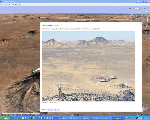
An example of a pause in the tour showing one of my images in context.
Viewing a tour in Google Earth
When you download this 21KB file (named 200701Sahara_link), it will be added to the Temporary Places section of your Google Earth. You can then open the folder and double-click on a named placemark to zoom to its location and see the image and description I’ve included.
The built-in tour feature provides an even more interesting option to “fly” from one to the next.
- Turn off the checkbox for all placemarks by unchecking the “My Places” box at the top, then turn on the checkbox for the newly-added “Western Desert adventure” folder. Now only the placemarks for it will be visible.
- In the Tools | Options… dialog box, select the Touring tab and turn on the checkbox labelled “Show balloon when tour is paused”. I recommend fairly slow speeds for the fly-to and tour (I use 0.1) and a tour pause of 10 seconds or so to enable you to read the descriptions. Click OK to save the settings.
- Maximize your screen view by toggling off the toolbar (Ctrl-Alt-T) and the sidebar panel (Ctrl-Alt-B).
- Start the tour with Ctrl-Alt-P (or use the Tools | Play Tour menu). GE will move between my placemarks, displaying the image and description I included for each one. Click anywhere to stop the tour.
Note that some of the locations in the White Desert do not have high resolution imagery. Where there is detail, a slow connection may not have sufficient time to load it before the tour continues. You can overcome this by setting the tour to repeat a number of times: each time it is at a location, more detail will be added to the cache. (The control for this is in Tools | Options…, Touring dialog as “Play Tour XX Times”.)
My images in Panoramio
The people who started Panoramio had an interesting idea: why not use the latitude/longitude information within the EXIF data in a digital image to locate it on the planet? Apparently Google thought it was a good idea too, and acquired the company in 2006.
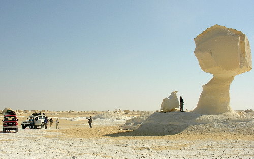
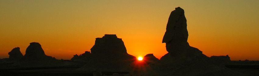
Mushroom formation in chalk, White Desert. ©2007, Eric Fletcher.
I used Picasa 2.6 to geotag a larger version of the above image. The Picasa tool let me navigate within Google Earth to where the image was taken, then wrote the lat/long information into the image’s EXIF header. When I uploaded it to the Panoramio site, their application used the EXIF data to accurately place the image. Click here or on the above image to see it in Panoramio’s site.
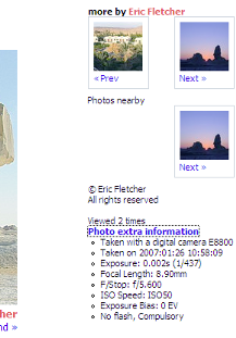
A Panoramio page shows an image and lets you add comments. In addition to seeing where the image was taken, if it was taken with a digital camera, the “Photo extra information” will show the camera make and exposure details from the EXIF header data. A “Google Earth” button at the top of the page adds a network link to enable Google Earth to display tiny thumbnails of the images instead of the Panoramio logo.
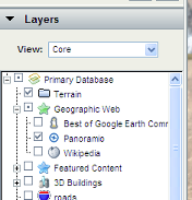
If you turn on the Panoramio subset of the Geographic Web layer in Google Earth, icons representing Panoramio images will appear in the Google Earth view. When clicked, they open the picture and provide a link to other pictures by the same contributor.