Hong Kong... to hike! |
||||||||
|
|
||||||||
| Hong Kong as a hiking destination? Hmm... In 1983, we'd found it
exciting and exotic - but the only hiking we remembered was from one
shopping destination to another.
But a browse through the Hong Kong Tourism Association's website page and the wonderfully-illustrated "Exploring Hong Kong's Countryside" book by Edward Stokes whetted our appetites. And so, as arrived in the magnificent new Chek Lap Kok airport in the evening of April 3rd, we were eager to explore. First impressionsHong Kong is booming! New roads and bridges, exciting architecture... everywhere we looked, we saw things being changed. It's a lot cleaner than we remembered it and despite the handover to China in 1997, English is seen and heard everywhere. Shopping is not the bargain it may have once been but it's still a lot of fun. We loved the sounds and smells of the food markets where you can buy almost anything you'd care to eat -- or not! And don't miss a visit to the Temple Street night market in Kowloon: even though it was drizzling lightly, the awnings kept us dry and the selection of clothing and, well, stuff was amazing. You just have to wonder what kind of factories produce things like tiny plastic watches shaped like skulls. And, why there are apparently enough people buying such stuff to make it worth their while! We weren't surprised to see how people still live in what would be unbearably crowded conditions for most North Americans. However, some of the newer suburbs of Hong Kong consist of forests of high-rise apartment buildings with well-planned roads and public transit access and attractive landscaping. The 7.5 million or so people in Hong Kong live in about 12% of the land area and although it is still crowded, it is well thought-out and has advantages over the sprawling suburbs we're more used to. The biggest advantage is the subway and public transit system, which moves huge numbers of people efficiently and inexpensively. And we used the system to get from the bustle of downtown to the starting point of several walks; some of which were within sight of the city but others were remote enough to make us forget where we were.
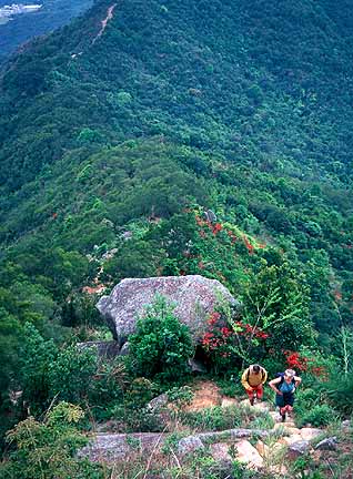
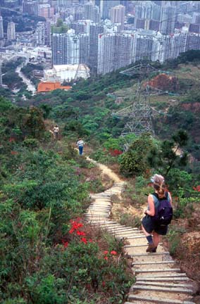
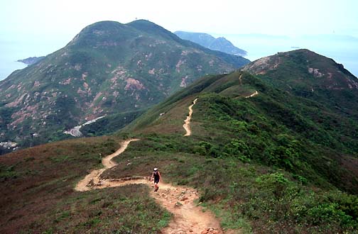
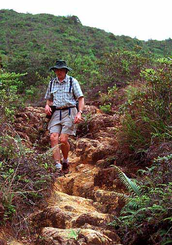
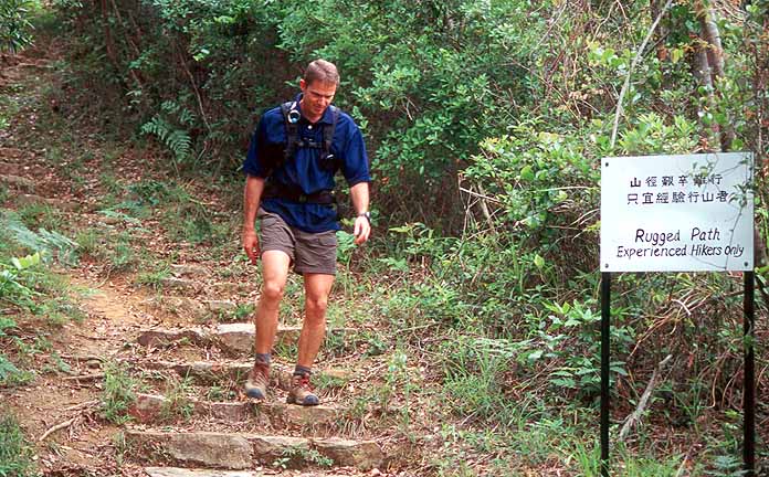
There are plenty of easily accessible hikes to choose from. One morning, we walked up a street from our hotel in the suburb of Sha Tin and followed the trail up to the ridge overlooking Kowloon and Hong Kong. The views along and up the ridge to Lion Rock were well worth the rather rigorous climb. After enjoying the panorama of ribbons of city amongst the forested hills, we descended steeply down the other side into Kowloon - and took the subway back to our hotel in Sha Tin for an early dim sum dinner! Other hikes were almost as easily accessible: we were particularly pleased to be able to fit in a hike along the Dragon's Back trail on Hong Kong island and be back in time for lunch. From the subway stop at Shau Kei Wan, the #9 double-decker bus wended its way up the narrow and twisty road over the pass and along the edge of the D'Aguilar Peninsula. We got off just before Shek O and climbed up the trail along the ridge. More vistas of the South China Sea and the picturesque village of Shek O below... The trail leads back along the ridge to connect back to the road where we took the bus back to the subway stop and lunch. How were the trails? They varied from excellent to terrible but almost all were well marked. Our biggest beef was how many of them were being paved in concrete. We suspected that whoever made the decision to use concrete had never hiked on it -- or perhaps they had only hiked on concrete sidewalks and their feet were used to it! A good map is worth getting, even if you have one of the several good books about the trails. While we were there in April, the weather was fairly clear (albeit a bit more humid than we'd expected) but it could become stormy or foggy quite quickly. A frequently recommended emergency item is a cell phone: you'd seldom be out of range and you'd fit in well with the >2.3 million other cell phone users in Hong Kong! What can you see?Great views of the South China Sea and the bays, inlets and islands around the territory. You can even swim at some of the beaches. We saw lots of birds, some local monkeys - macaques - and lizards. Most interesting though was the blend of intense human habitation and near wilderness. "Near" because the entire territory has been extensively logged and farmed at various times in its history. But in many places, we only saw signs of people if we really looked.
Some links from here
Last updated on 06 December 2001 . |